Pre-Veteran's Day Americana Auction
Lot 42:
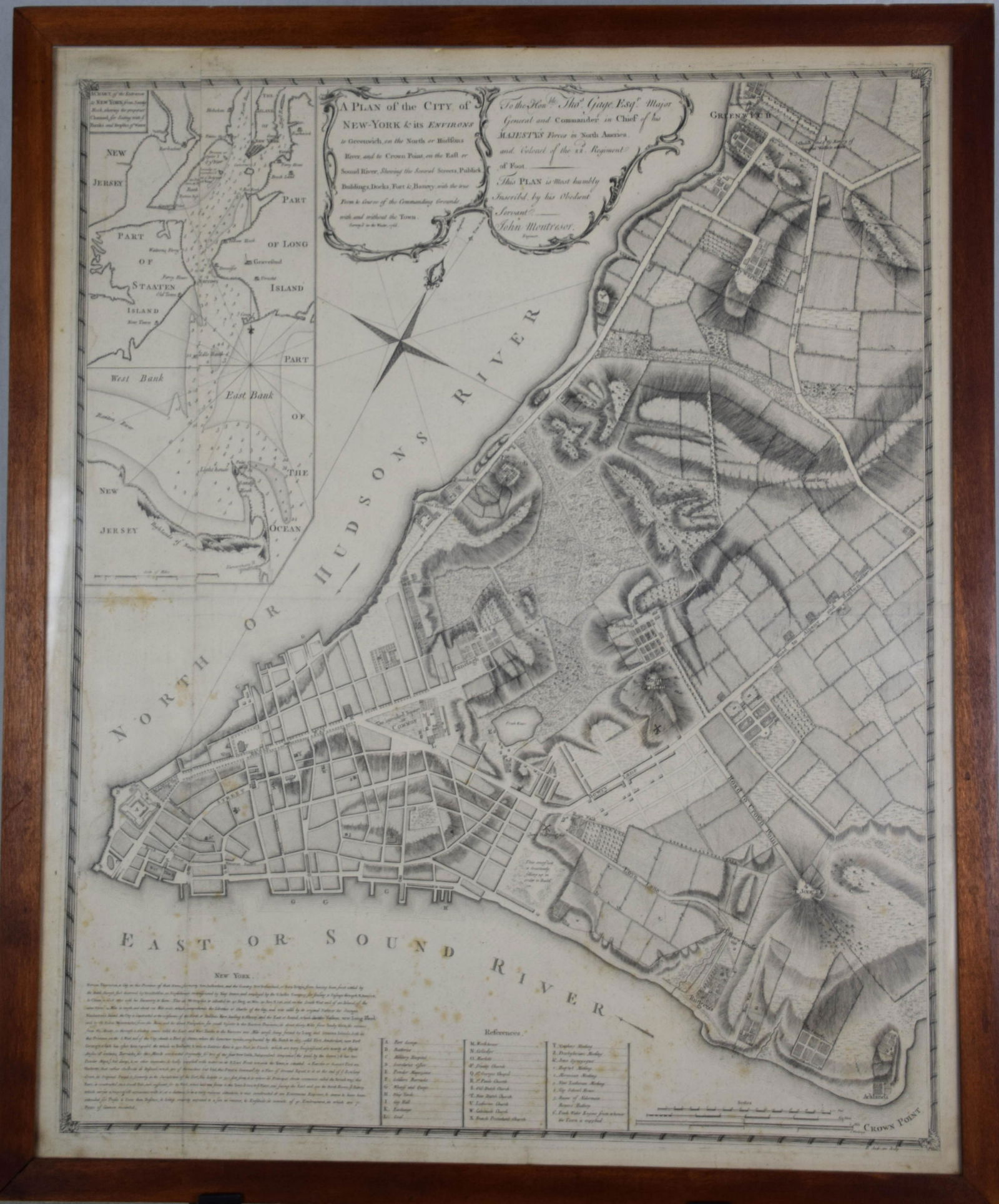
Description
This very rare map is a first edition “Montresor Plan” after the military engineer who created it. The map entitled “A Plan of the City of New York and its Environs to Greenwich on the North or Hudson River…survey’d in the Winter, 1766”. At the time of the survey, New York was furious over the passage of the Navigation Acts, Quartering Act, and the odious Stamp Acts. Fearing open revolt, General Thomas Gage, commander-in-chief of the British forces headquartered in New York, ordered engineer Lieutenant John Montresor to prepare a map of the city and its surroundings. Although the first edition of the map proved to be somewhat unsatisfactory, it was the first map to detail the area north of Manhattan to present day Greenwich Village, as well New York harbor and the surrounding islands. Very few maps of the first edition were produced, making this map exceptionally rare. A later edition was printed in 1775 and used extensively during the Revolutionary War. Dimensions: 23.5" Length 28.5" Height
Condition: Minor foxing/ a few spotting. Very clean. Minor discoloration along the border. Faint creasing along the middle of the map. Overall excellent condition. Not inspected outside frame.
Share this lot: