Summer Abstract and Fine Arts and Collectibles Auction
Lot 120:
Description
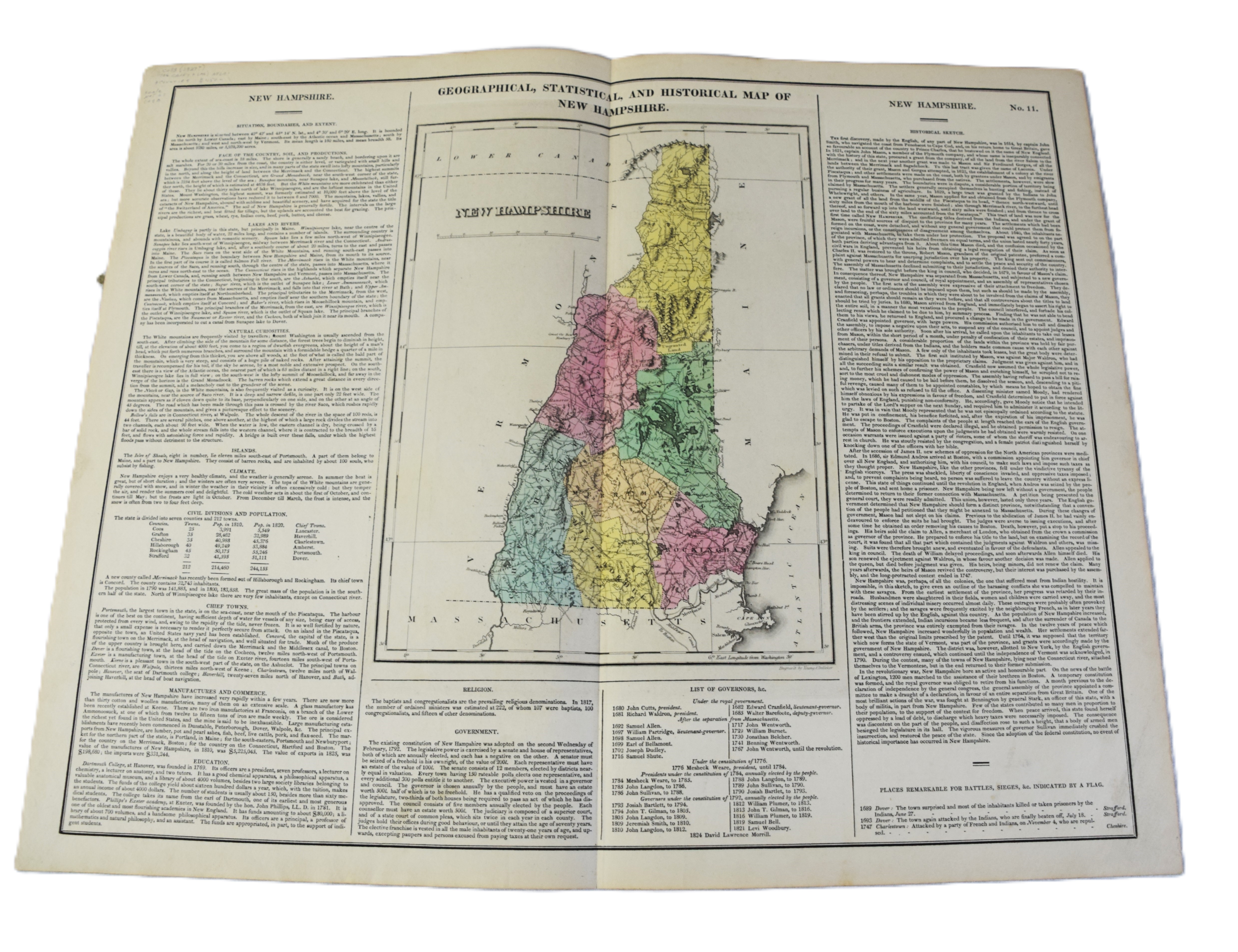
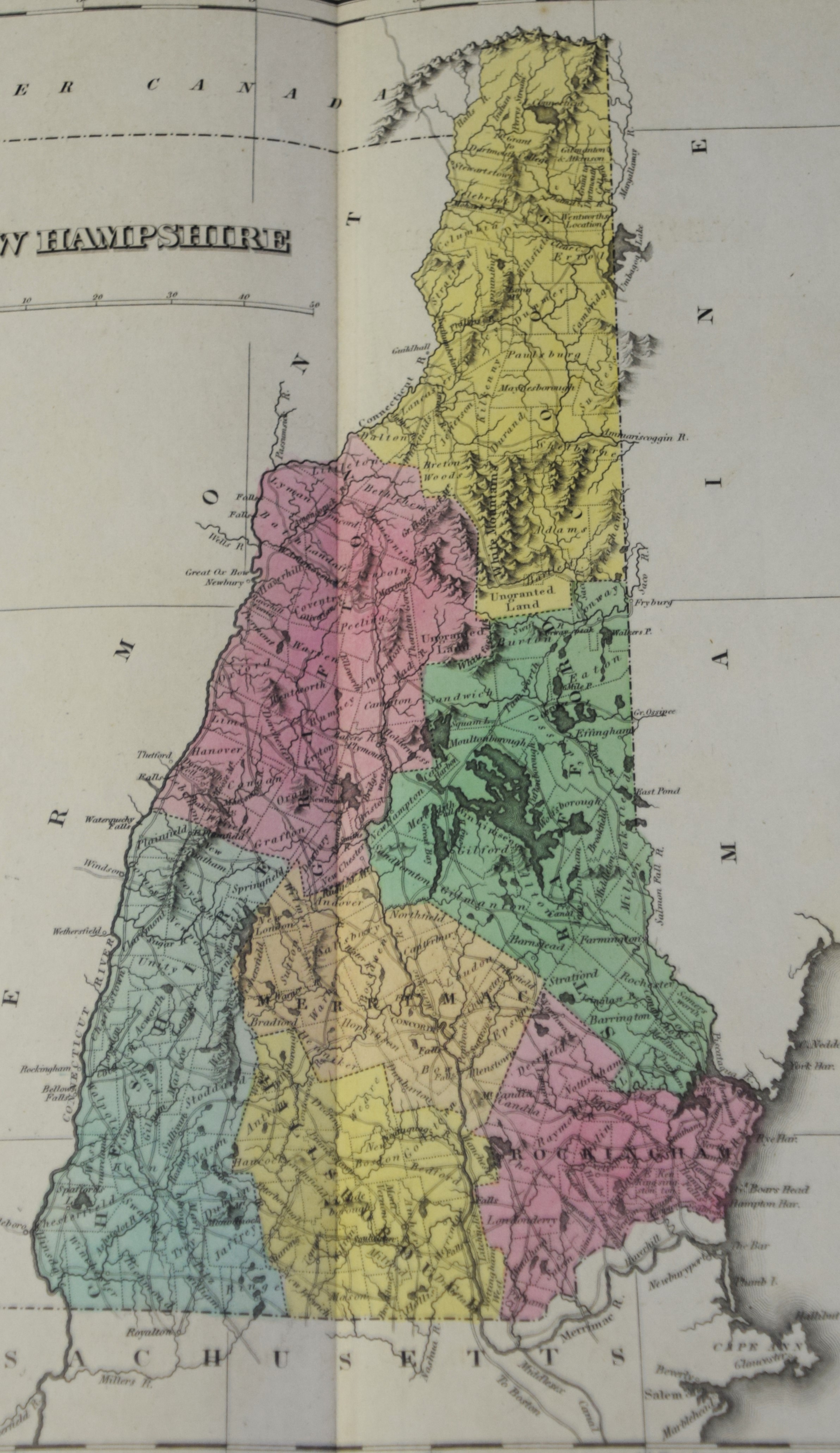
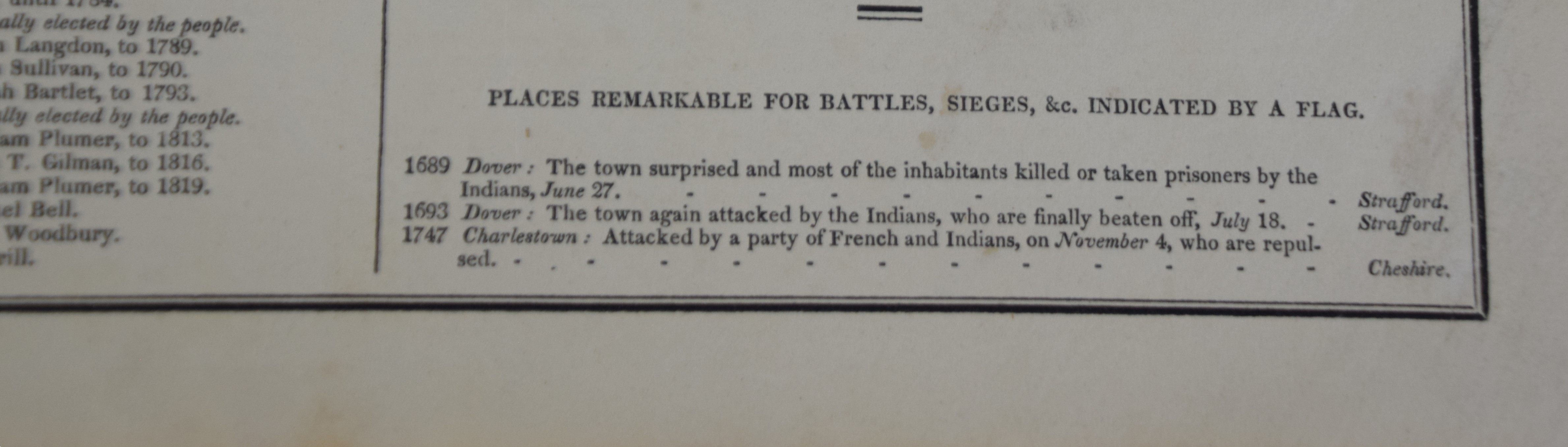
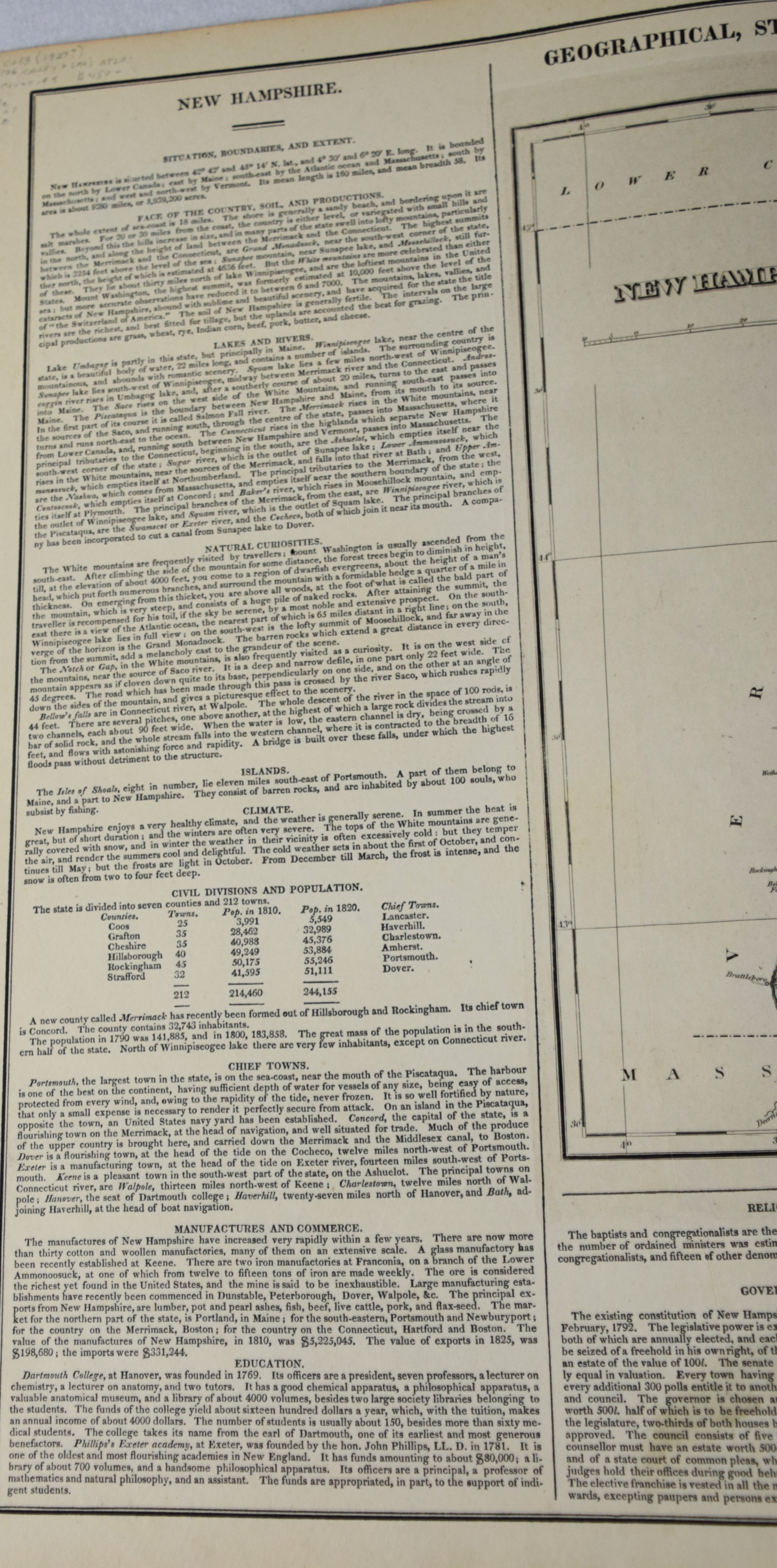
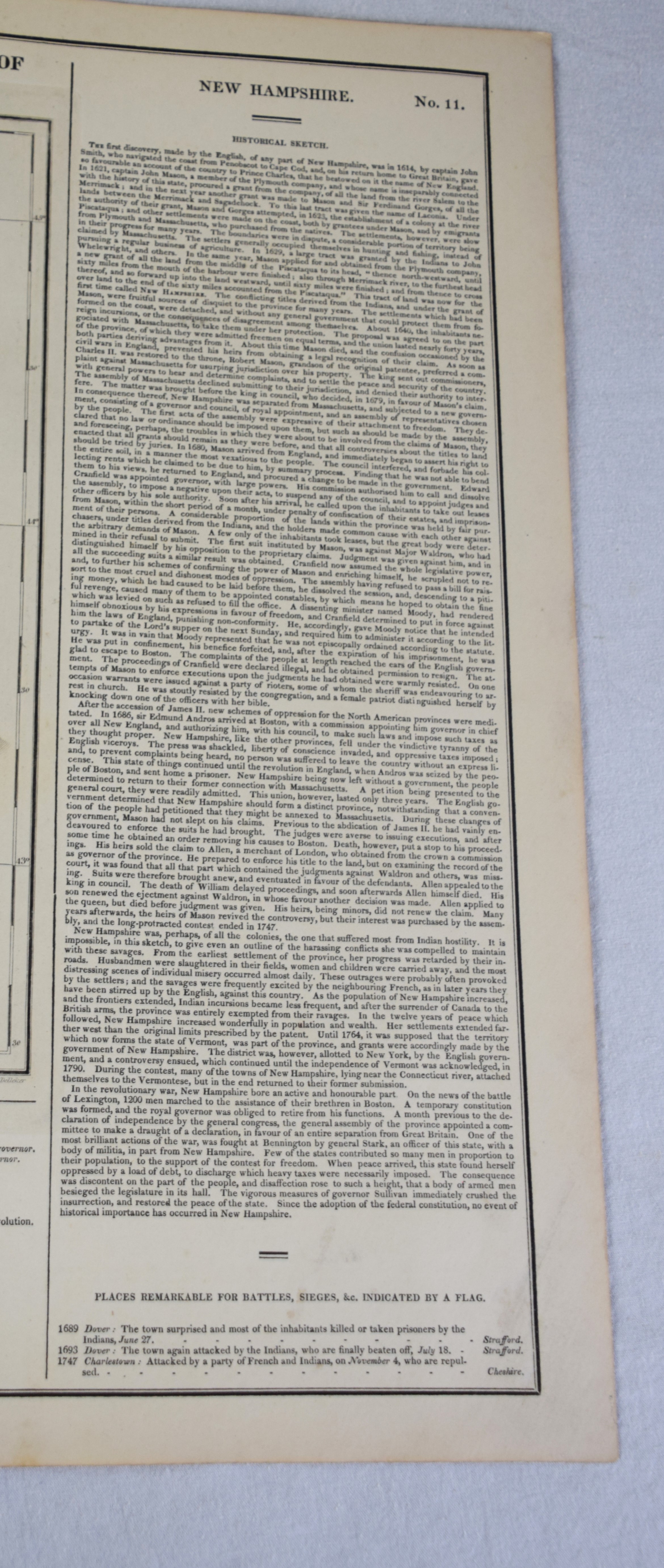
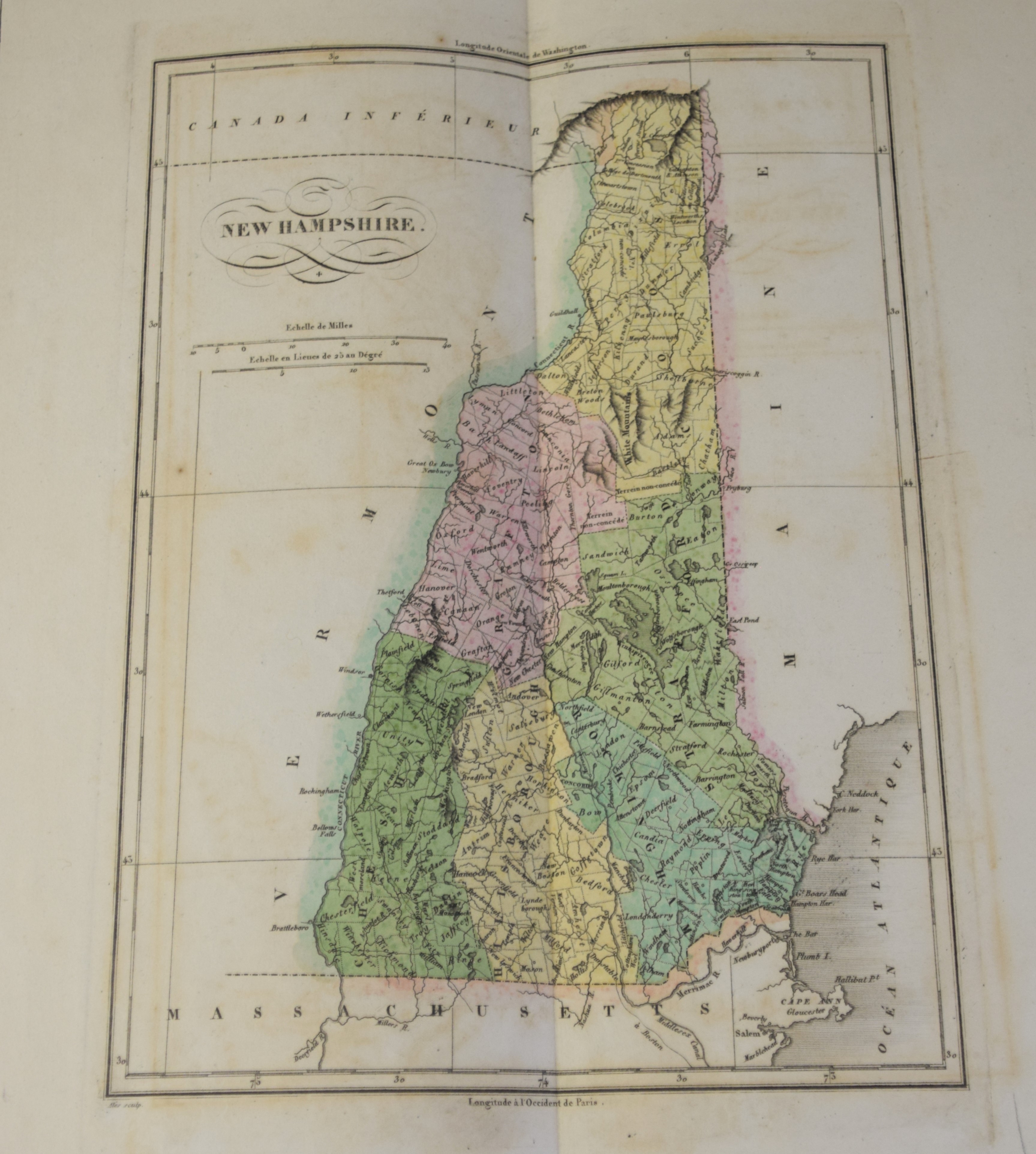
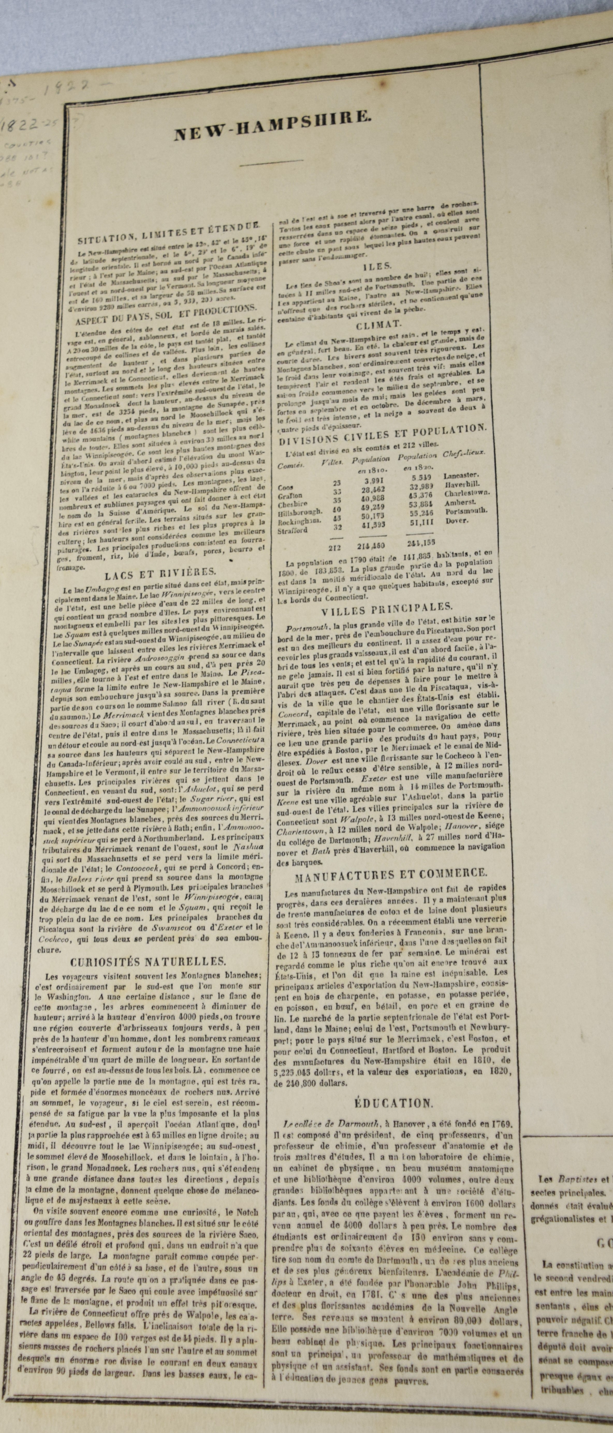
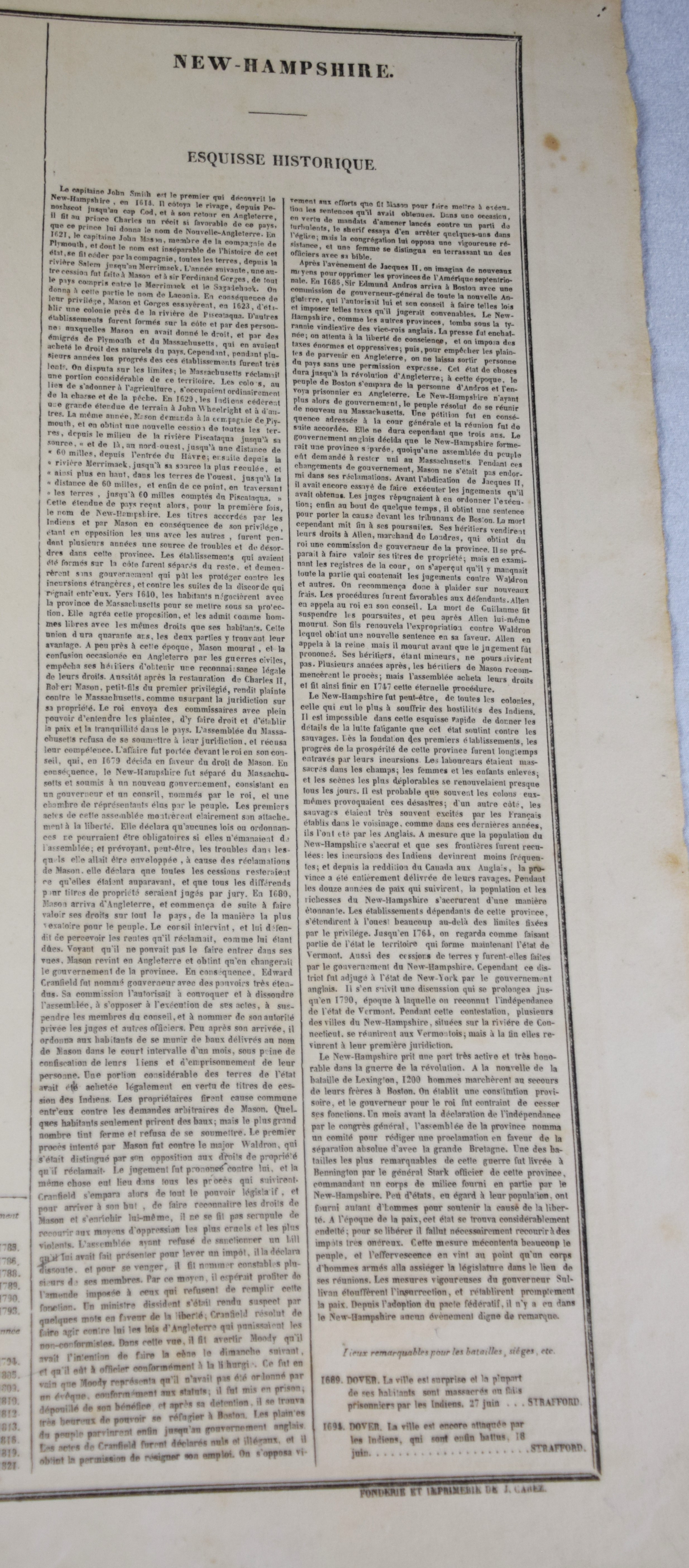
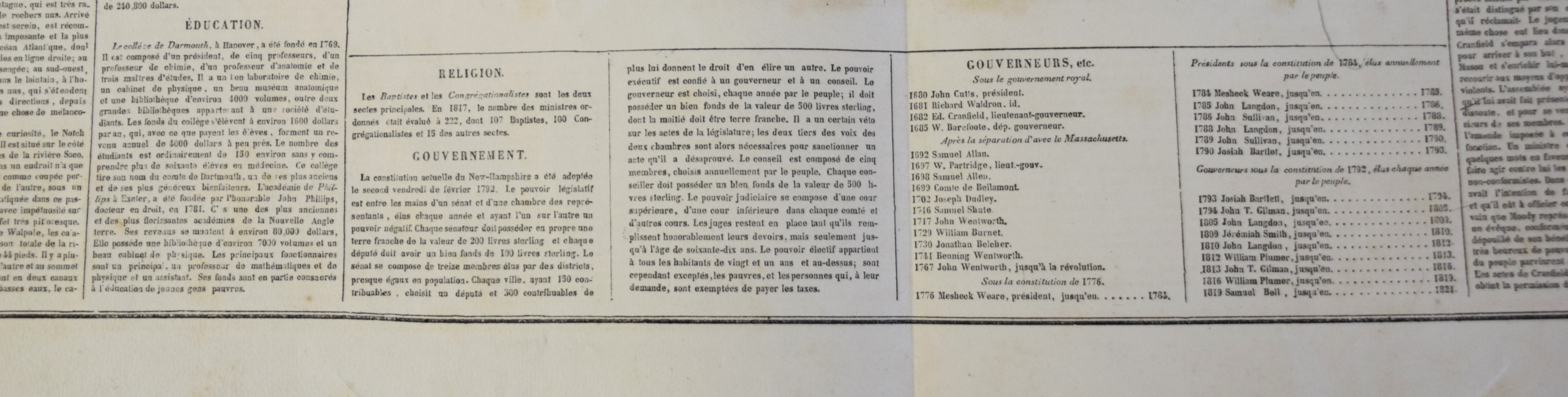
Geographical, Statistical and Historical Map of New Hampshire in an American and French version, circa 1825. An interesting historic and geographic overview of New Hampshire from the first quarter of the 19th century. This detailed map of New Hampshire presents the state organized into townships and counties, the latter delineated by fine hand color. The White Mountains are prominently depicted in a pictorial fashion ; while other geographic features, transportation routes, and “places remarkable for battles, sieges, etc.” are also shown. The sheet was issued as plate number 11 in the 1826 edition of Carey & Lea’s A Complete Historical, Chronological, and Geographical American Atlas. Dimensions: 18″ x 22″
Condition report:
Very good condition, center fold
Share this lot: